Atlanta Pattern Analysis
       
     
process.png
       
     
pattern+matrix.jpg
       
     
2_Neighborhood-Scale_nonconformities.jpeg
       
     
2_Neighborhood-Scale_parcel-size.jpeg
       
     
3_Block-Scale_summary-table.jpeg
       
     
210401_Photo-Overlay_Townhouse_952-968-Charles-Allen-Dr-NE-01-1400x1400.png
       
     
2024-03-29 Land Use Axons_medium density mixed use.jpg
       
     
2024-03-29 Land Use Axons_resi flex.jpg
       
     
Atlanta Pattern Analysis
       
     
Atlanta Pattern Analysis

Grounding Policy in the City’s Lived Form

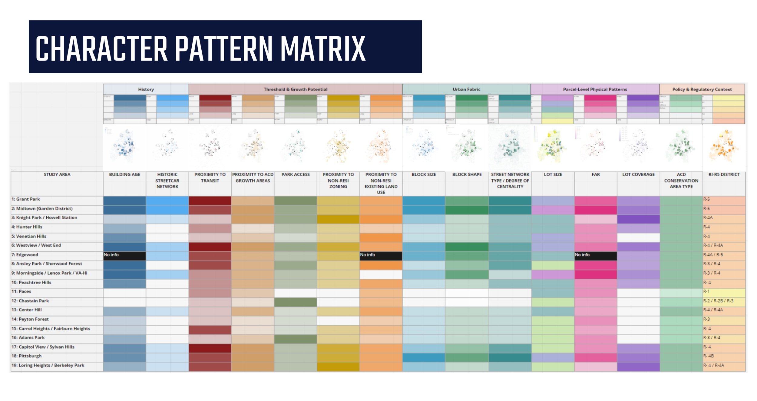
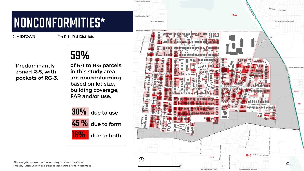
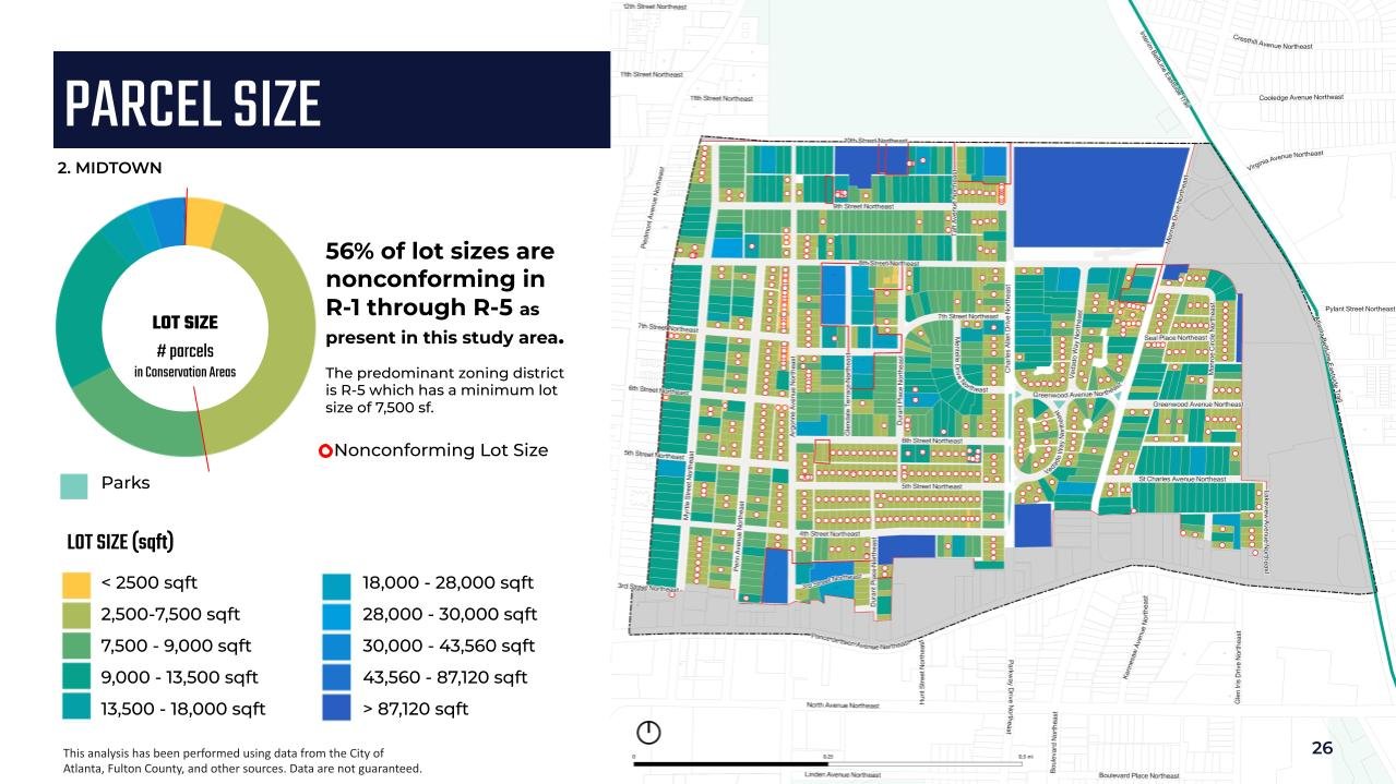
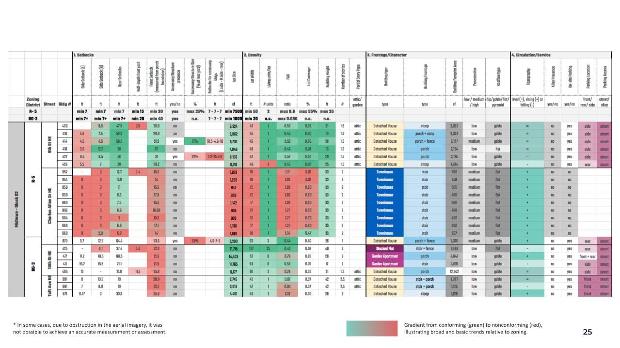
As part of Atlanta’s citywide zoning rewrite, we analyzed how neighborhoods actually function on the ground—across city, district, block, and building scales. The work revealed patterns, gaps, and opportunities that are now informing a more flexible and responsive zoning framework. Watch this video to learn more.

This project was developed with the Utile and TSW teams.

process.png
       
     
pattern+matrix.jpg
       
     
2_Neighborhood-Scale_nonconformities.jpeg
       
     
2_Neighborhood-Scale_parcel-size.jpeg
       
     
3_Block-Scale_summary-table.jpeg
       
     
210401_Photo-Overlay_Townhouse_952-968-Charles-Allen-Dr-NE-01-1400x1400.png
       
     
2024-03-29 Land Use Axons_medium density mixed use.jpg
       
     
2024-03-29 Land Use Axons_resi flex.jpg